HAND DRAWN MAPS
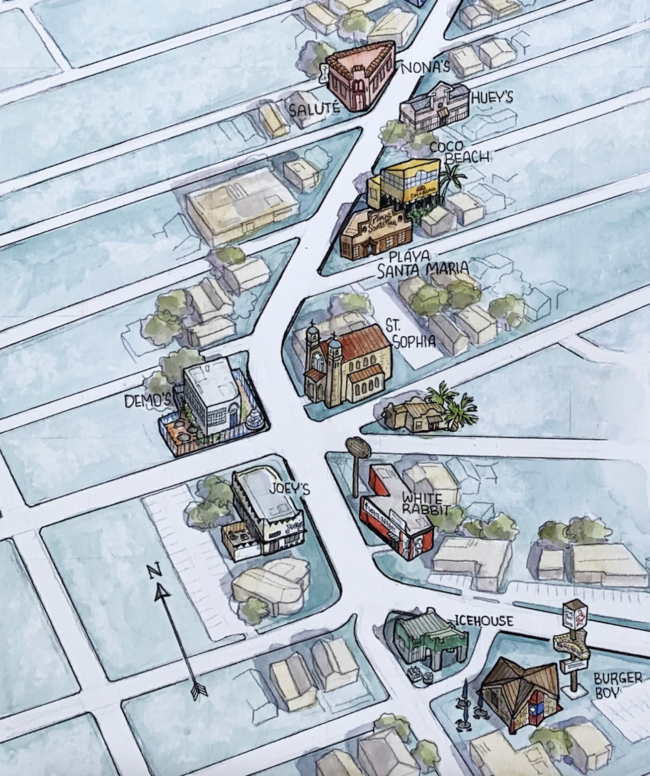
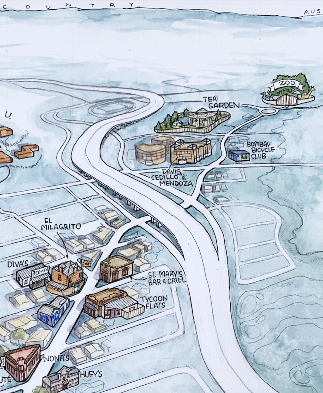
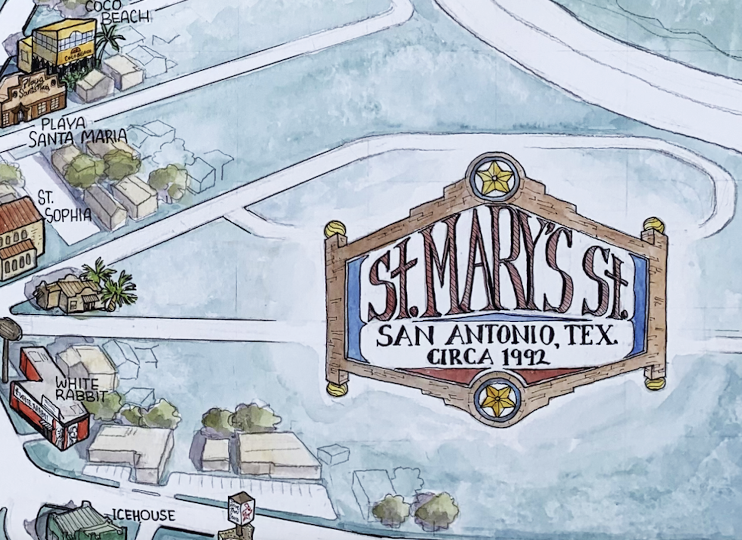
ST. mary’s Street, San ANTONIO (Circa 1992)
2025, watercolor and ink | This commissioned map portrays the major landmarks of St. Mary’s Street in San Antonio, Texas, as they appeared during its heyday in the early 1990’s. Several of the bars and restaurants shown here no longer exist or have been renovated, though many remain in business in their original state.

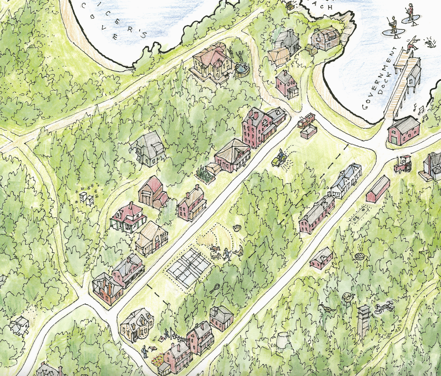
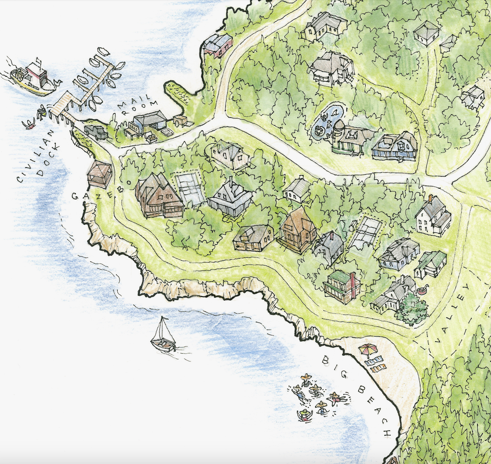
CUSHINGS ISLAND, MAINE
2025, watercolor and ink | A client commissioned this map of Cushings (also spelled “Cushing” or “Cushing’s”) Island in southern Maine’s Casco Bay region. The map includes depictions of homes, landmarks, and personal items, along with two views of the bay. A decorative title cartouche incorporates objects tied to the island’s history as an Abenaki shellfishing ground, a U.S. military fort, and a summer colony.


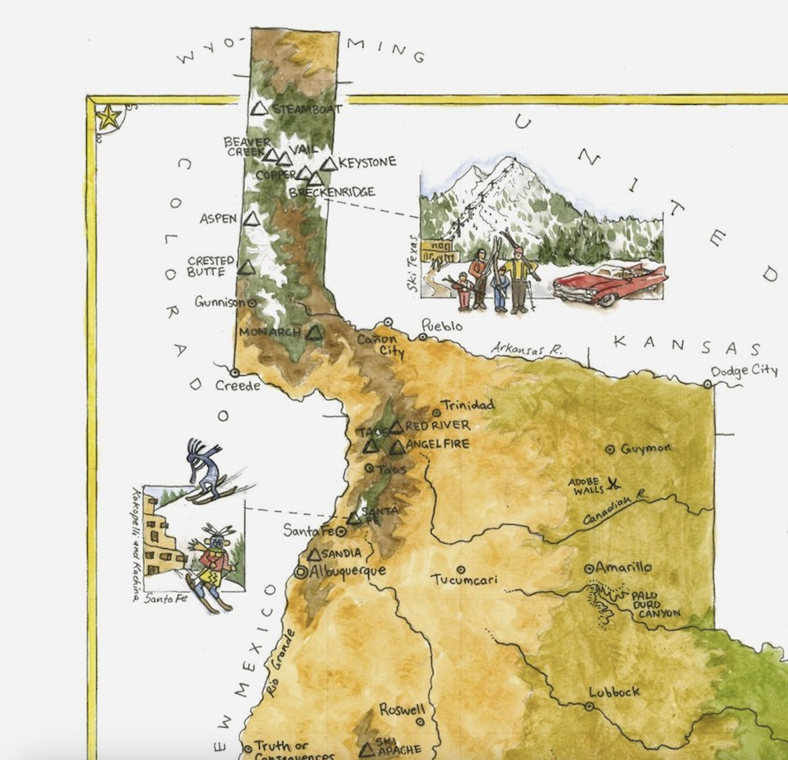
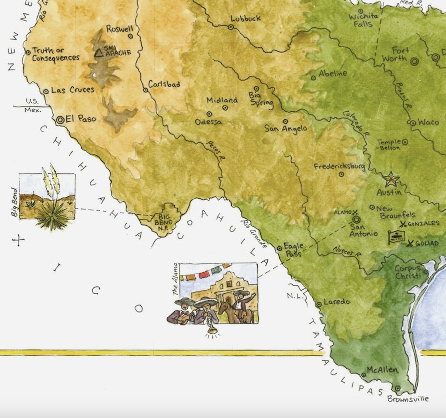
REPUBLIC OF TEXAS
2025, watercolor and ink | This commissioned map imagines an alternative history where the Republic of Texas (1836–1845) survived into the present day with its original claimed borders. Having gained parts of New Mexico, Oklahoma, Kansas, Colorado and Wyoming, the independent nation boasts one thing the modern-day state lacks: plentiful skiing. Shown here are the various ski resorts of the Republic, along with other personal and historical points of interest.


THREE WAYS TO THE CREEK
2020, watercolor and pen | A map showing three different walking routes that I took around my neighborhood during the COVID pandemic. Published in CityLab’s Quarantine Atlas: An Anthology of Maps from Readers Around the World.


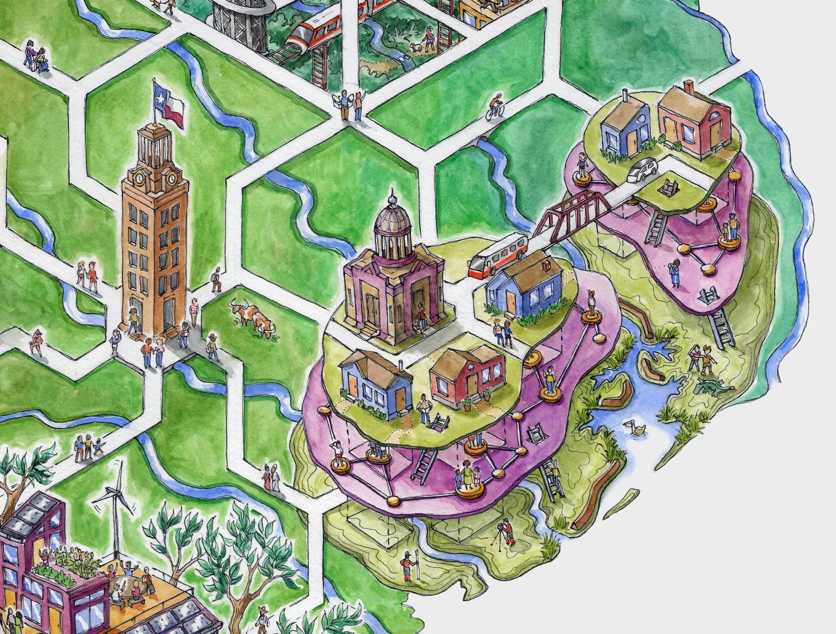
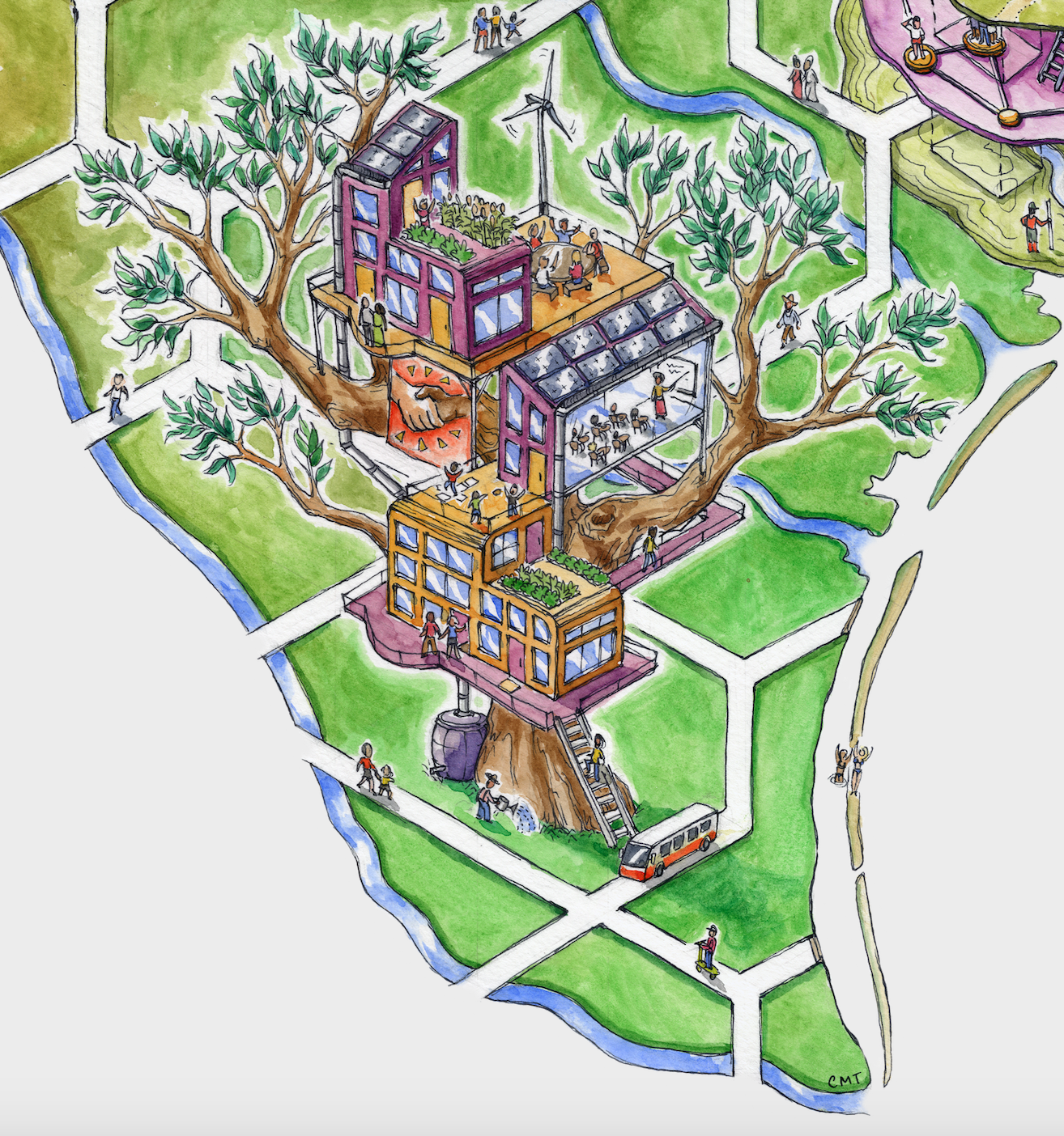
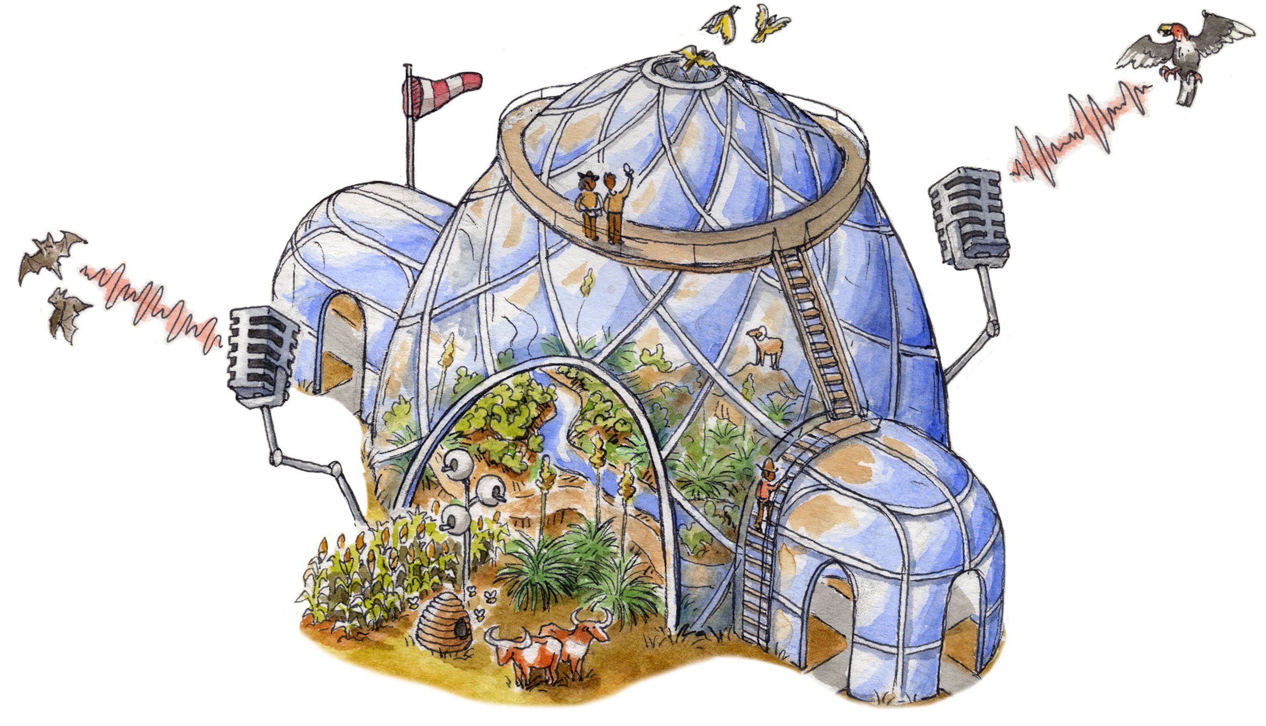
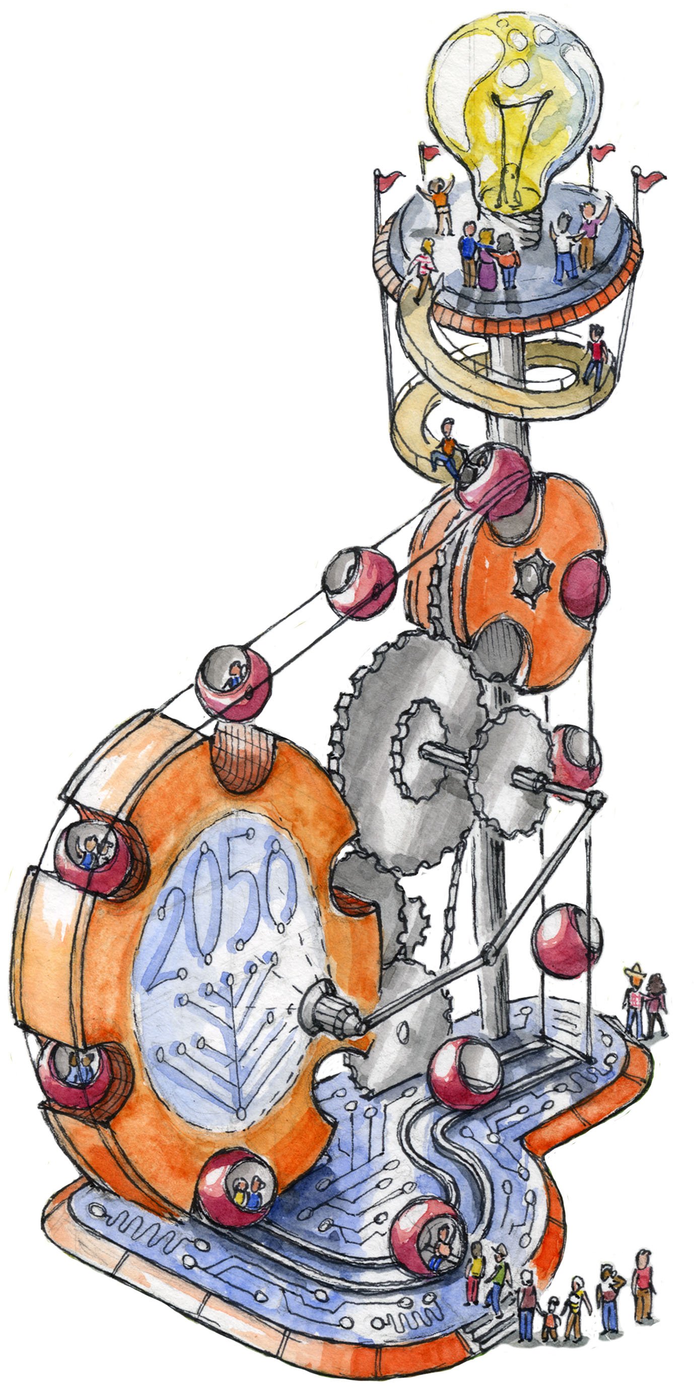
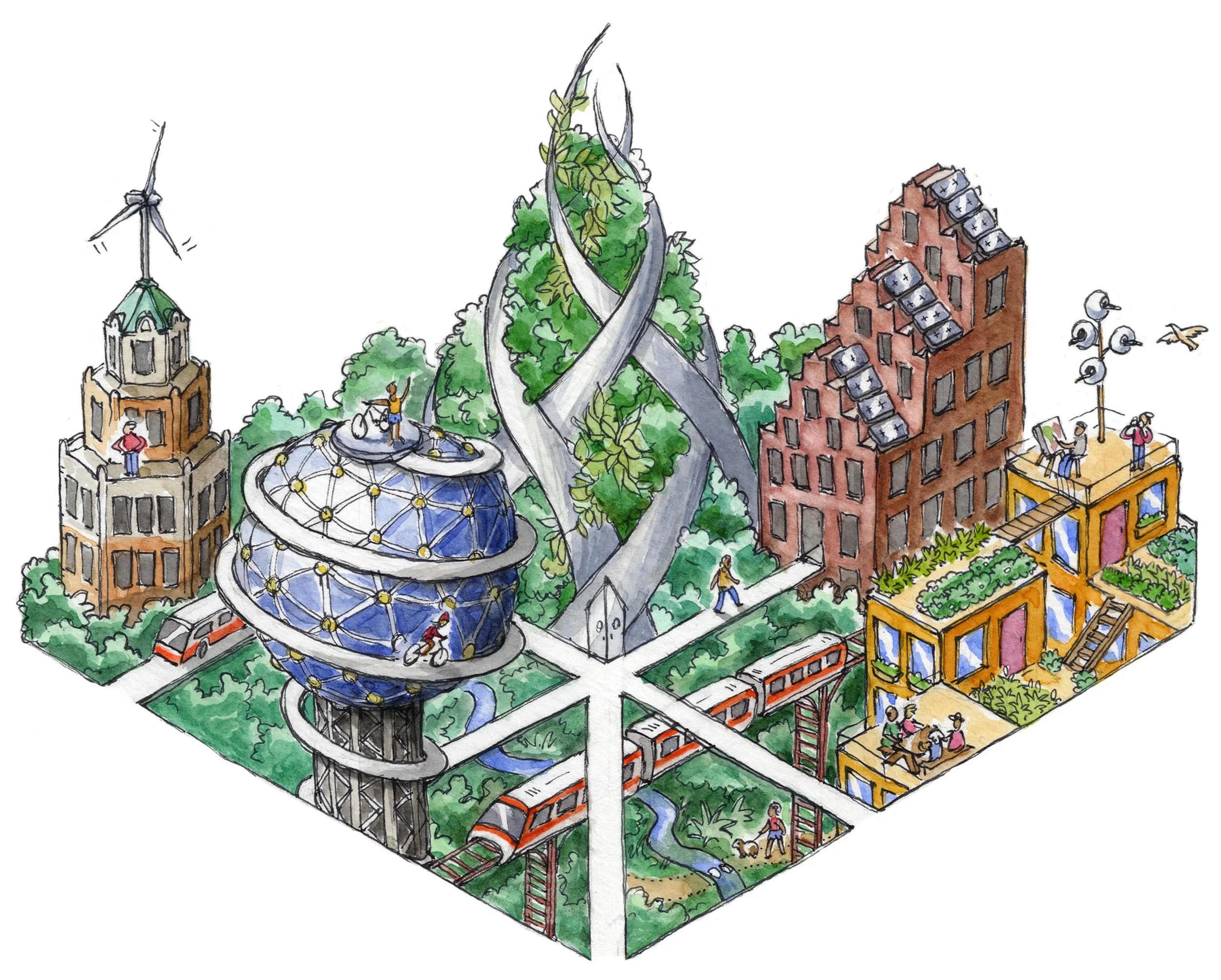
Planet Texas 2050
2020, watercolor and ink | This infographic was commissioned by the University of Texas at Austin to illustrate Planet Texas 2050, an interdisciplinary research initiative that seeks to answer questions relating to adaptability and resilience in the environmental future of Texas. The map is divided among six distinct scenes each representing one specific constituent flagship project.


THE road to productivity
2020, pen illustration | A COVID-era map showing the obstacles on the road to productivity. Published in Atlas Obscura


THE CAPITAL-LAND ATLAS
2021, pen illustration | A parody of the 14th century Catalan Atlas on a contemporary American canvas. Billionaires shown as medieval kings.


